Flying High with BVLOS
Why Centimeter-Level GNSS Accuracy Will Define the Drone Economy
On August 7, 2025, the FAA published its long-awaited Part 108 Notice of Proposed Rulemaking, a landmark regulation that sets the framework for Beyond Visual Line of Sight (BVLOS) drone operations in the U.S. This shift replaces the patchwork of waivers with a standardized system that empowers drone operators, manufacturers, and automated data service providers (ADSPs) to scale BVLOS missions safely and reliably. But one critical factor will decide who thrives in the new drone economy: affordable centimeter-level GNSS accuracy.
Why BVLOS Needs Precision Positioning
Unlike line-of-sight flights, BVLOS drones must navigate without human oversight. That means accuracy is everything:
- Urban navigation – Precise GNSS keeps drones in digital flight lanes, avoiding no-fly zones and altitude violations.
- Shared airspace – Centimeter-level accuracy prevents mid-air conflicts between multiple UAVs.
- Takeoffs and landings – Safe, repeatable operations near infrastructure demand more than meter-level GPS can deliver.
Without high-integrity GNSS, the promise of BVLOS (safe, autonomous, scalable) cannot be realized.
What Part 108 Demands
Part 108 introduces new operational roles, certificates, and accountability measures. Crucially, it shifts the burden of airspace safety and cybersecurity to operators.
To comply, UAV systems must be:
- Reliable – operating in complex and dynamic environments
- Resilient – with auditable data integrity
- Automated – minimizing human intervention
That makes GNSS RTK (Real-Time Kinematic) positioning a regulatory enabler, not just a technical upgrade.
GNSS RTK: Built for Scale
Network-delivered GNSS RTK provides:
- Centimeter-level accuracy without local base stations
- High-performance receivers optimized for UAV size and power constraints
- Encrypted, authenticated signals to meet FAA cybersecurity requirements
For operators, this means lower costs, broader coverage, and compliance-ready positioning technology.
BVLOS in Action
Centimeter-accurate GNSS unlocks real-world use cases:
- Urban delivery – Safe rooftop and curbside drop-offs in crowded airspace
- Infrastructure inspection – Precise hovering near powerlines, pipelines, and railways
- Agriculture – Coordinated swarm drone operations for spraying, planting, or monitoring
- Emergency response – Accurate, repeatable flight paths for search, rescue, and disaster mapping
UAV Case Studies

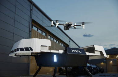
BRINC hones in for public safety agencies with u-blox

Stellaire.ai: Transforming Utility Inspections with Autonomous Drones and u-blox PointPerfect
The Bottom Line
FAA Part 108 ushers in a new era of BVLOS drone operations, but it raises the bar for precision and accountability.
The winners of this new drone economy will be those who adopt affordable, Western-built GNSS RTK solutions that deliver centimeter-level accuracy, cybersecurity, and scalability.
Because in the future of BVLOS, precision isn’t optional, it’s the foundation.
u-blox provides a range of precision GNSS RTK solutions which enables drone operators to affordably and with confidence to conform with the FAA guidelines.
Neil Hamilton: Marketing & Sales Services, Product Center Services, u-blox
Get in touch for orders or any queries: sales@rfdesign.co.za / +27 21 555 8400
Courtesy of u-blox

